


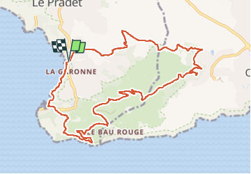
Boucle plage de la Garonne - Fort de la Bayarde

Daniel.BRUN-PICARD
User


5h14
Difficulty : Medium

FREE GPS app for hiking
 SityTrail
IGN / Geographical institutes
SityTrail Plus
The world is yours!
About
Trail Walking of 13 km to be discovered at Provence-Alpes-Côte d'Azur, Var, Le Pradet. This trail is proposed by Daniel.BRUN-PICARD.
Description
Belle randonnée avec de magnifiques points de vue, effectuée par un superbe beau temps. Merci aux animateurs du Touring Club du Var qui nous ont guidé à travers les multiples variantes d'itinéraire.
Positioning
Comments